Rivers are important habitats for a range of fauna and flora. Monitoring the quality and distribution of physical habitat parameters in rivers, such as water depth, grain size and flow velocity, is vital for species survival. This is especially important in light of climate change’s potential impacts and other anthropogenic activities including engineering works, water abstractions and unsustainable land use practices. In recent decades, the collection of aerial photography and other forms of remote sensing datasets has provided a valuable means of mapping and monitoring river habitats.
Unfortunately, it is rarely possible to map a variety of different habitat parameters simultaneously using these datasets since they fail to provide enough detail for reliable mapping at fine scales. Mapping habitats at these fine scales is particularly important for ensuring species health and survival during changing conditions.
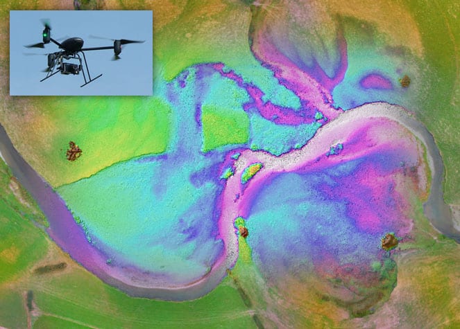
Recently, the development of drones for civilian scientific applications has provided a new method for mapping and monitoring river habitat parameters. Small, lightweight drones can be flown at low altitudes above river corridors to collect very detailed aerial photos. Parallel developments have occurred in drone-related software packages, which are now capable of processing multiple drone photos (covering small areas) into scaled image mosaics and digital 3D models covering much larger areas. For the first time, these mosaics and 3D models are enabling accurate and reliable mapping of a range of habitat parameters within rivers at very fine scales.
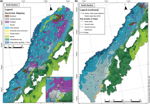
Geomorphological mapping of the Piedra Blanca site on the San Pedro River, Chile.
In the review article “Drones and digital photogrammetry: From classifications to continuums for monitoring river habitat and hydromorphology” published in WIREs Water, Amy Woodget and colleagues at the University of Worcester examine the unprecedented benefits of drone imagery. Examples from rivers in England and Chile show how river habitat parameters can be mapped and measured directly from drone image mosaics and 3D models. The review also highlights the current challenges of data collection using drones, including adverse weather effects on flight safety, a rapidly evolving regulatory landscape, the obscuring effect of overhanging trees and muddy waters, and the need for careful checking of the accuracy of image and 3D model outputs.
As a result, the review recommends continued systematic research to improve drone-based habitat mapping approaches. Important considerations for those interested in using drones for environmental work include financial implications, specific application needs and drone pilot responsibilities. Drones have already started to revolutionise ways of mapping and monitoring river habitats, providing new information with the potential to enhance knowledge about how rivers behave and evolve. This new information will help to determine how rivers should be managed in future to reduce the risk of species decline and loss.
Contributed by Amy Woodget.
Thanks to Paul Attwood (of Attwood Media) for providing imagery used to create the featured image.

